Studies
Richmond/Henrico - I-95/64 Overlap Study
What's Being Done
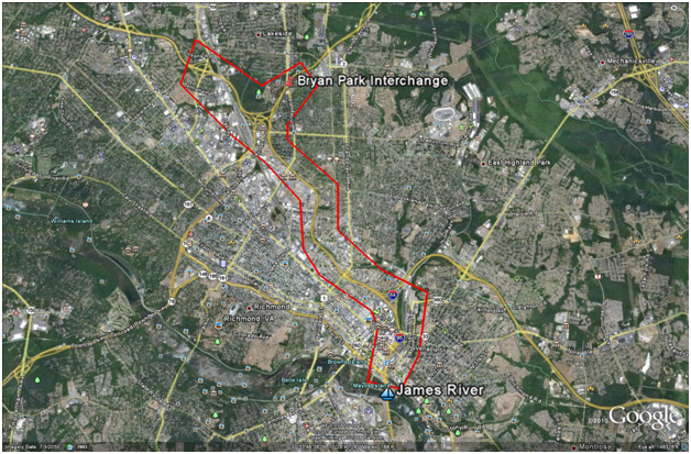
The Virginia Department of Transportation (VDOT) conducted a planning study in 2012-2013 of the I-95/64 Overlap area in the City of Richmond and Henrico County. The purpose of this study was to identify potential transportation capacity and safety improvements within the study area. Several potential improvements were identified as part of the study.*
The study area was approximately 10 miles long and included I-95 from just north the Hermitage Rd Exit (mm 81) to the James River (mm 73) as well as I-64 West from Staples Mill Rd to the Bryan Park Interchange and I-195 from Laburnum Avenue to the Bryan Park Interchange.
*This project will be scored under the new prioritization process as outlined in House Bill Two. Funding has been removed from this project in the draft revision of the 2015-2020 Six-Year Improvement Program. Visit the Commonwealth Transportation Board's prioritization information page for more.

Documents
- Appendix A
- Appendix B
- Appendix D
- Appendix E
- Appendix F
- Appendix G
- Appendix I
- Appendix J
- Appendix K Existing 2011
- Appendix L Future No-Build 2022
- Appendix M Future No-Build 2035
- Appendix N Future Build 2022 SYIP Projects
- Appendix O Future Build 2022 Long-Term Concepts
- Appendix P Future Build 2035 SYIP Projects
- Appendix Q Future Build 2035 Long-Term Concepts
- Appendix R
- Appendix S
- Appendix T
- Comment Resolution Memo 032713
- I-95 I-64 Overlap SYIP Projects Eleven
- Overlap Final Report 032713 No Appendix


